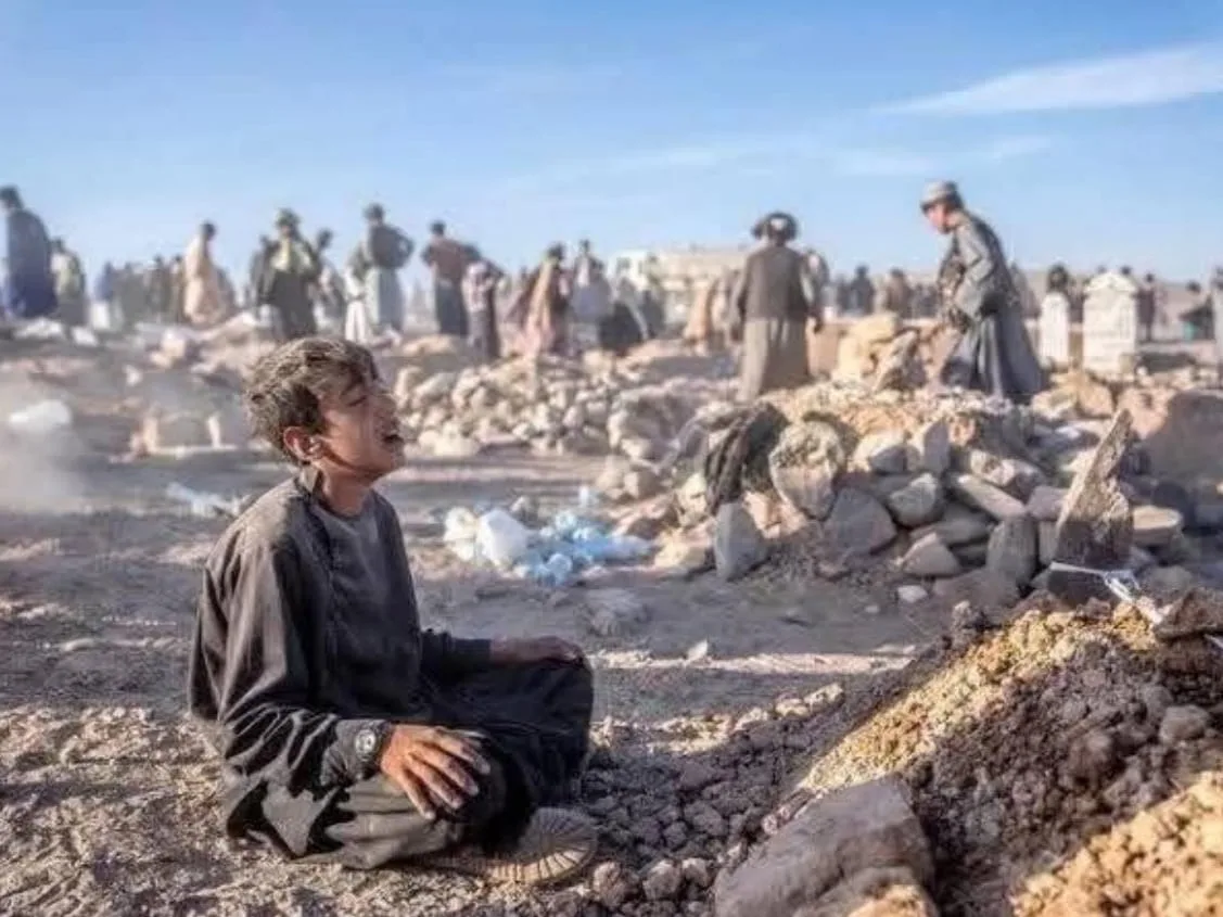
A cloudburst over the Kheer Ganga River (a tributary of Alaknanda River) led to flash floods in the high-altitude villages of Dharali in Uttarakhand Uttarkashi district.
A major disaster hit Dharali village in Uttarkashi, Uttarakhand, on August 5, 2025. A powerful cloudburst caused heavy rainfall and triggered flash floods in the area. As a result, a rush of muddy water from the Kheerganga river swept through Dharali.
This destroyed homes, hotels, roads, bridges, and markets. The ancient Kalpkedar temple was buried under debris and suffered significant damage…
About Cloudburst
A cloudburst is a severe weather event defined by a sudden, intense, and highly localized rainstorm, often exceeding 100mm in an hour. This typically happens over a small area. Cloudbursts commonly occur in mountainous regions, such as the Himalayas, which include parts of Uttarakhand and Himachal Pradesh
1) A cloudburst is a localized, extremely intense rainfall event where more than 100 mm of rain falls within an hour over a small area which is typically about 10 km2…
2) Cloudbursts are particularly common in mountainous regions, such as the Himalayas, due to topographical and meteorological factors.
Reasons for Cloudbursts:
- Orographic Lifting- Moist air is forced upward by mountains, causing it to cool and condense rapidly, resulting in intense rainfall.
- Upward Air Current- Strong vertical currents can suspend raindrops at high altitudes; if these currents suddenly weaken, accumulated water falls in a short burst …
- Monsoon Dynamics- In India, monsoon clouds traveling from the Bay of Bengal or Arabian Sea rise sharply upon hitting the Himalayas, creating optimal conditions for cloudbursts.
- Climate Change- Rising global temperatures allow the atmosphere to hold more moisture, increasing both the frequency and intensity of cloudbursts in recent years.
District Flood Severity Index:
The District Flood Severity Index (DFSI) is a composite index developed by researchers at IIT Delhi and IIT Gandhinagar. It measures flood severity at the district level in India. The main goal is to provide a detailed, data-driven tool for planning, managing disasters, and improving relief efforts in the administrative units that are most relevant for response..
About District Flood Severity Index (DFSI):
- DFSI is a data-driven tool designed to assess and categorize flood severity at the district level, India’s primary administrative unit for planning and disaster management.
- The index is used to identify districts most at risk and guide resource allocation for mitigation and response.
Key Parameters Considered used in DFSI
- Mean duration (in days) of all flooding events in a district.
- Percentage of district area historically affected by floods.
- Total deaths and number of people injured due to floods.
- Population size of the district ..
Remember facts DFSI :
- Thiruvananthapuram District: Recorded highest number of flood events. However, it is absent from the top 30 most severely affected districts, indicating lower severity per DFSI criteria.
- Top Districts in Flood Severity: Patna ranks one on DFSI. Districts in Assam (Dhemaji, Kamrup, Nagaon) and along the Indo-Gangetic Plain dominate the top ranking ...visit here
The DFSI is seen as a crucial step for managing floods and preparing for disasters in India. It focuses on both the natural aspects of floods and their effects on people, property, and local governments. for state news link yourself here www.eminentnews.com